Hong Kong to keep T3 alert until Sunday noon, and assess need for higher one later as Typhoon Koinu nears
[ad_1]
The No 3 typhoon warning, issued at 5.40pm on Friday, will remain in force until at least noon on Sunday, and the Observatory said it would consider whether to issue a higher warning that afternoon.
“According to the present forecast track, Koinu will be closest to Hong Kong later tomorrow, skirting within 150km south of the city,” Kong Yu-chau, an acting senior scientific officer at the Observatory, said.
“Depending on the change in local wind strength by then, the Observatory will assess the need for the issuance of higher tropical cyclone warning signals.”

At 10pm, the Observatory estimated Koinu was about 160km (99 miles) southeast of Hong Kong and was forecast to move “slowly” west or west-northwest across the waters off Guangdong.
“Under the influence of Koinu, strong winds are prevailing offshore with occasional gales on high ground locally,” it said. “Its associated gale winds still remain at some distance from Hong Kong.”
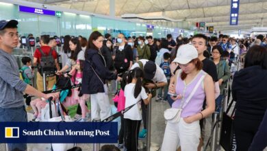
Classes at kindergartens and special schools were suspended on Saturday as a precaution as Koinu, the Japanese word for puppy and named after the country’s term for the Canis Minor constellation, moved closer to the city.
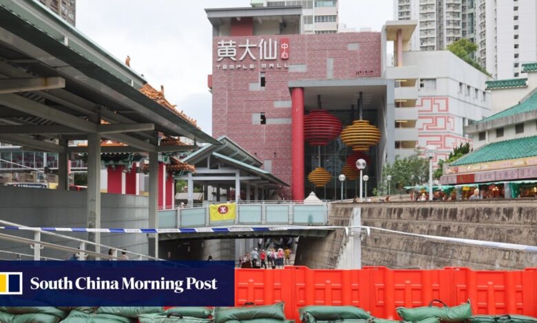
Staff at Wong Tai Sin’s Temple Mall North put up flood barriers along the top of the stairway down to the entrance. Sandbags were used to anchor the barriers in place.
The lower ground level of the shopping centre was flooded in last month’s record-breaking rainstorm. Water poured from higher ground into the building down the stairway. The floor is still off-limits to the public.
Hong Kong’s T3 alert for Typhoon Koinu to remain in force until Sunday morning
Hong Kong’s T3 alert for Typhoon Koinu to remain in force until Sunday morning
Flood barriers and sandbags were also in place at the entrance to an underground car park in Chai Wan’s Wan Tsui Estate, which suffered severe flooding in last month’s storm, and pumps have been installed to help control water levels.
The torrential rain also triggered a landslide on Yiu Hing Road in Shau Kei Wan, near Yiu Tung Estate. Large rocks, trees, and debris were washed down the slope and blocked the road.
Secretary for Transport and Logistics Lai Sai-hung said in a blog on Saturday that the Highways Department contractor had cleared about 150 tonnes of rocks and debris from the road and would finish the installation of a barrier net this week.
He added the government would later remove other debris and stabilise the boulders at the top of the slope.
As Koinu weakens and moves away in the middle of next week, a dry northeast monsoon is expected to bring fine weather to the Guangdong coast, with the mercury climbing to 30 degrees.
Experts blame climate change for Hong Kong floods, warn of more extreme events
Experts blame climate change for Hong Kong floods, warn of more extreme events
The Security Bureau reported on social media that it had convened a meeting on Friday with representatives from 14 policy bureaus and departments.
Acting security minister Michael Cheuk Hau-yip was briefed on the preparation work and contingency plans drawn up for Koinu.
The bureau said the emergency monitoring and support centre would be activated to coordinate the emergency response if a higher level warning was issued.
[ad_2]
Source link