
China is making progress in promoting international logistics, the transport minister said on Wednesday in Beijing.
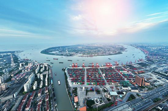
For instance, the country has proactively expanded the international logistics network and made significant progress. International maritime routes connect major ports worldwide, with container vessels servicing over 100 countries and regions globally. China has consistently ranked at the forefront of global maritime connectivity for several years, according to Li Xiaopeng, the transport minister, at a news conference.
In terms of air freight transportation, China’s international air cargo services reach more than 60 countries and regions worldwide, with Hong Kong and Shanghai standing out as the world’s top and third-largest international air cargo hubs, he noted.
Additionally, agreements on international road transport have been signed with 22 countries involved in the Belt and Road Initiative, while the China-Europe freight train service has linked over 220 cities across 25 European countries.
In addition, efforts have also been made on enhancing the service capabilities of international freight transport, and received progress in all perspectives including maritime shipping, air transport, international express delivery and international road transport, Li said.
A comprehensive international logistics service system has been established, with international maritime shipping handling over 95 percent of China’s import and export cargo volume. International air cargo services have emerged as the primary mode of transportation for high-value and time-sensitive goods. Last year, a total of 3.11 billion international and cross-border mail and express deliveries were completed, providing robust support for the rapid growth of cross-border e-commerce.
In addition, 17,000 China-Europe freight train services were operated last year, carrying 1.9 million containers. Meanwhile, international road transport saw a 105 percent year-on-year increase in freight volume last year.