Good communications and high level of preparedness spared Hong Kong the worst of Super Typhoon Saola, some say, but others maintain the city got lucky
[ad_1]
Chan added that the earlier start to damage limitation work, as well as effective communication with the public, was a good reference point for the future, especially the practice of giving advance warnings for storm signals.
“External messaging has also made citizens treat the typhoon seriously and be more careful when taking precautionary measures, reducing accidents in the process,” he said.

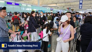
Saola, which triggered the first No 10 warning, the highest level, in five years, brought the city to a near standstill.
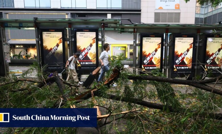
Public transport was suspended, scaffolding was torn from buildings and dozens of trees were toppled.
Authorities reported at 4pm on Saturday that Saola had left 86 people injured and toppled more than 1,500 trees. There were also 21 reports of flooding.
But the damage from Saola reported so far is a fraction of the havoc wreaked by Typhoon Mangkhut in September 2018 when almost 460 people were treated in hospital and 60,000 trees were uprooted.
The city’s No 2 offical Eric Chan Kwok-ki led a steering committee to spearhead preparation efforts for Saola and held a press conference on Thursday to warn the public of the impending No 8 storm signal a day before it was released.
The new strategy was part of the lessons learned after Mangkhut hammered Hong Kong.
The typhoon, in addition to the high injury toll, marooned the city’s workforce after thousands of commuters became stuck in a citywide traffic jam once the observatory removed all warning signals.
The Buildings Department was also seen to have tackled the public’s concerns about residential blocks swaying during the storm on its social media platforms.
Eunice Yung Hoi-yan, a former vice-chairwoman of the security panel, said the government’s improvement in communication was a confidence boost for citizens.
“For No 8 signals in the future, if the government could alert parents, employees and firms earlier for preparation on school and work arrangements, this would be a worthy point of reference,” Yung said.
Social scientist Sonny Lo Shiu-hing agreed the Observatory’s “much earlier” announcement of the Typhoon Signal No 8 and the government’s readiness plans had contributed to the minimal post-typhoon disruptions.
He added the government’s preparation before Saola struck was also attributable to the adoption of a “broad definition” of national security, a concept designed to cover 20 areas, including public and economic security.
Typhoon Saola leaves debris, fallen trees on Hong Kong roads, but impact small
Typhoon Saola leaves debris, fallen trees on Hong Kong roads, but impact small
But residents and representatives in areas vulnerable to the effects of typhoons said luck had also played a part in minimising damage from the storm.
Yau Tong West district councillor Lui Tung-hai said there was little flooding, debris or damage.
“The government preparations were earlier and more complete this time, I think this is good and necessary,” he said. “The result we see now could be related to being well-prepared. Of course, it could also be due to the typhoon’s wind direction and the tide.”
Roger Mak Sau-leung, the vice-chairman of the owners’ committee of Heng Fa Chuen, said if Saola had hit the estate during the morning spring tide, the damage suffered would have been similar to that caused by Mangkhut.
But he said the estate only suffered about six trees uprooted.
Mak added that the estate’s insurance company paid out about HK$40 million (US$5.1 million) in claims after Mangkhut, but he expected the Saola bill to be not more than HK$5 million this time.
The estate suffered serious flooding and destruction in the wake of Mangkhut, with residents left without electricity and water for days.
Mak said the estate had prepared well for Saola, including the use of watertight gates at the seafront entrances to each block of flats.
Shun Chi-ming, who headed the Observatory when Mangkhut slammed Hong Kong, said the city was spared the worst because Saola appeared to have weakened during its final approach to the city.
“The weakening of Saola’s eyewall was apparent, especially on the eastern side. Its strongest parts skirted round Hong Kong in the south and the urban areas were spared hurricane force winds,” Shun said in a social media post on Saturday.
Observatory figures showed Saola’s maximum sustained winds dropped from 205km/h (155mph) to 175km/h when it moved across the city’s southern waters, dropping from a super typhoon to a severe typhoon.
Shun said that some flats at the Lohas Park development in Tseung Kwan O had their windows shattered and that many other buildings in the city could have suffered the same if Saola’s most powerful winds had not spared urban areas.

The Observatory had earlier warned Tolo Harbour in the New Territories would have “historic” sea levels caused by a storm surge of more than 4 metres (13 feet) on Friday evening.
The actual biggest surge measured by the tide gauge at Tai Po Kau, which opens to Tolo Harbour, was only 1.42 metres, although it still managed to cause minor flooding along the riverbank cycling track at Shing Mun River in Sha Tin.
The recorded high tide of 3.31 metres above chart datum, the original mark, was well below 6 metres predicted by the Observatory.
When Mangkhut caused extensive flooding along Shing Mun River, the Tai Po Kau gauge registered a tide level of 4.71 metres above chart datum.
The historical record of 5.03 metres is still held by 1962’s Super Typhoon Wanda.
Hong Kong cannot afford to be caught off guard by arrival of Saola
Hong Kong cannot afford to be caught off guard by arrival of Saola
Shun said that the Observatory has been using the sea, lake, and overland surges from hurricane (SLOSH) computer model developed by the US National Weather Service to estimate storm surge heights.
“It seems that the Observatory needs to do more research to improve the accuracy of storm surge prediction,” Shun said,
But he admitted it had always been difficult for forecasters to accurately predict structural changes in a tropical cyclone.
Saola and Mangkhut approached Hong Kong from the south.
Choy Chun-wing, the Observatory’s acting senior scientific officer, said only southern parts of the city experienced hurricane force winds of 119km/h or higher because of Saola’s compact size.
He explained that, as Tolo Harbour was farther away from Saola’s storm eye, the area did not get hit by hurricane force wind as it did five years ago.
He said tide predictions were based on Saola’s ability to hold onto its super typhoon strength as it crossed the South China Sea and promised the Observatory would continue to hone its forecast accuracy with the use of technology.
[ad_2]
Source link